Friday, June 3 2022
By Mohamud Haji Elmi
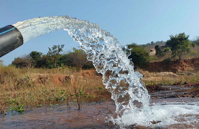
Unknown aquifers may have a prompt answer to the frequent drought, which decimated many animal populations and significantly affected the region’s livelihood. The recent huge aquifers discovered in northern Kenya in Turkana County are evidence supporting my statement. The Lotikibi Basin Aquifer, estimated roughly the size of Rhode Island or half of Belgium, was unknown until recently. This underground lake covering an area of 4,146km², holds a volume of water of 200,000,000,000 m³ (Two hundred billion cubic meters), equivalent to twice the size of Lake Leman in Switzerland. These massive groundwater reserves are potentially enough to slake Kenya’s thirst for generations. As a result of this survey, the estimated total renewable groundwater resources storage of northern- central Turkana is 247 billion m³ for a total recharge capacity of 3.42 billion m³ per year, representing 1.38% of the full storage quantities.
Study Area
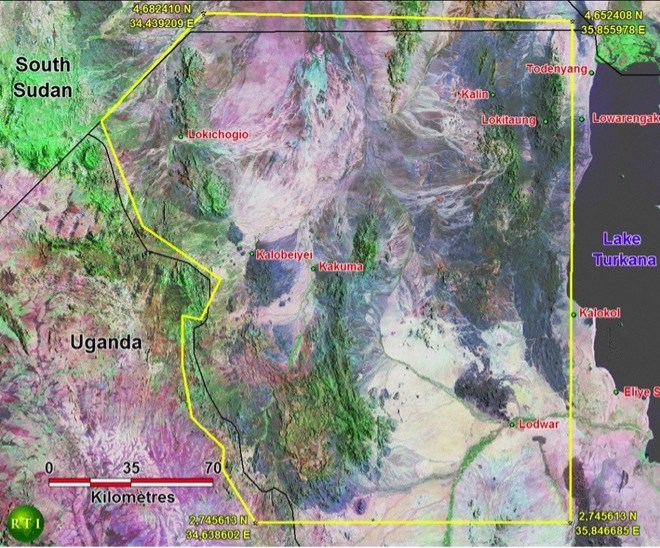
Figure 1.1. Location of the study area, northern and central Turkana. RTI, 2012. Colour coded SRTM image: the high altitude is coded in orange and the lower altitude in blue. The red polygon identifies the study area. Notice the two major watersheds, the Fafem in the West and the Jerer in the East, flowing from an altitude of 2500 m to 500 m.
The study area covers a zone of 36,000 km² of northern and central Turkana County, Rift Valley Province, as selected officially by the Government of Kenya (Ministry of Water and Irrigation) on 24 May 2012. The area’s southern boundary is at 2.7°N latitude, while its eastern boundary is west of Lake Turkana at 35.8°E. The south-western boundary is situated along the Uganda border, with a small coverage into Ugandan territory to account for critical watershed zones originating there. The north-western boundary follows Kenya’s border with South Sudan. The area’s northern boundary follows at 4.6°N latitude at the “Maud Line” of the Ilemi Triangle.
The three main towns are Lokichoggio in the northwest near the border of South Sudan, Lodwar in the southeast corner of the survey area, along the Turkwel River, and Kakuma, which has grown to become the most populated area with almost 500 000 persons, most of whom are refugees from neighbouring countries. A good asphalt road stretches from Lodwar to Kakuma and Lokichoggio along with a distance of 280 km. Kakuma, located about 590 km northwest of Nairobi by direct flight, can be reached by car in two days through a dust road. Turkana County is Kenya’s most arid region, and environmental experts believe that discovering the aquifer in the area must directly benefit the County’s mostly nomad community.
Another aquifer was found in Namibia - the continent’s driest country.
Since 2007, the German-Namibian Technical Cooperation project “Groundwater for the North of Namibia” is aimed to support groundwater management purposes for groundwater systems of the Cuvelai-Etosha Basin. The technical cooperation project is carried out by the Department of Water Affairs and Forestry (DWAF) and BGR. It is referred to as the DWA-BGR Project in this text. The Cuvelai-Etosha Basin (CEB) is a vast sedimentary system located in southern Angola and northern Namibia, and it spans about 165.000 square kilometres.
As the primary depression and collector for surface water, the Etosha Pan is the topographic centre of the CEB.
What is happening in some parts of Africa is a wake-up call for those who are in need of water but lack access to the aquifers beneath their feet. I hope Somalia, Chad, and Ethiopia will be among the following countries that will announce their potential groundwater resources in the future.
There is an ongoing process to unlock the substantial groundwater resources in Ethiopia.
The “Drilling Handbook of the Eastern Ogaden Basin” in the Somali Region of Ethiopia is a guide for drillers responsible for providing groundwater to local communities. All updated findings have been recorded in the “GENS” Navigation system delivered on user-friendly Ipads to the driller’s team, allowing drilling in rough field conditions and obviating the need for maps. All the maps exposed in the drilling handbook are extracted from the WATEX image recorded in the navigation system. The conception of this drilling handbook is in the continuation of the former “Drilling Handbook of the Fafem-Jerer” in the Somali Region, with hydro-geologic results linked to the current project.
Survey 1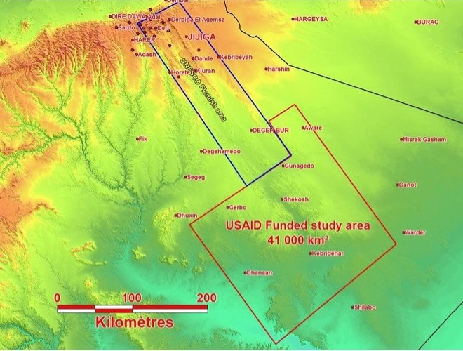
In 2012, continent-wide research conducted by the British Geographical Society found that Africa has huge groundwater reserves – perhaps 100 times more groundwater than water in lakes, dams and rivers. Despite the apparent abundance, researchers warned that these underexploited water reserves were insufficient to spur any green revolution, as irrigation would suck the aquifers dry before they could refill themselves naturally. It is said that 64% of Africa’s land mass is covered by transboundary aquifers, most of which are undiscovered properly.
Innovation
Dr. Alain Gachet founded RTI (Radar Technology International) in 1996 after spending years leading discovery efforts for multinational oil and gas companies. Dr. Gachet began experimenting with Geo-Scanner technology in 1999 while exploring structures linked to the genesis of gold and other base metals in the Republic of Congo. He utilized the technology to penetrate the rainforest canopy and reveal geological features beneath the ground’s surface. RTI’s proprietary WATEX System prospects and explores sub-surface water, soil and geology. The system enables and supports effective hydrogeological investigation within optimal certainty and results from years of research and development. WATEX produces groundwater target maps designed to assist policymakers, policymakers, and drillers in initiating large-scale water development and management projects. The map provides regional views of water resources, identify shallow and deep-water aquifers and can increase drilling success rates by 75% and 95%.
A history of helping people
In 2004, the Darfur crisis displaced 250,00 refugees in Chad and forced them into camps, with another 2 million people displaced in Sudan. Working with the United Nations High Commission for Refugees (UNHCR), RTI found enough water within four months to sustain the refugee camps in Chad and subsequently received funding to continue working in Sudan. There, Dr. Gachet and his team discovered enough water to support 3 million people.
Years later, Dr. Gachet and his team accurately detected the source and direction of water leakage in Libya’s Great Man-Made River, which sparked an effort to hone the technology’s use for the direction of aquifers. With a renewed sense of urgency to locate underground water, Dr. Gachet harnessed his decades of traditional oil and gas exploration experience to develop RTI’s patented water exploration and discovery system. WATEX™ RTI’s US counterpart is working to locate untapped water resources in Texas. Today, RTI is prepared to assist drillers in finding water using its patented WATEX™ maps and Groundwater Exploration Navigation Systems (GENS).
For more information contact;
Mohamud Haji Elmi - Water Management Consultant
Organisation: Drought & Flood Control Somalia
Website: www.drought-control.org
Email: [email protected]
London, UK